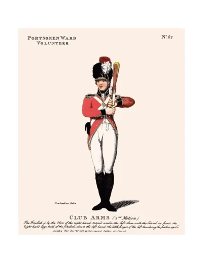

No. 62 Portsoken Ward Volunteers
£15.00
The Portsoken (scroll down for a more detailed Description)
The first reprints of the 1798 aquatints by Thomas Rowlandson (published by Rudolph Ackermann) published in 1972 by Hugh Evelyn Limited.
Image size is 20.5 x 25.5 cm [8” x 10”] against a light greyish orange background (c. RGB fcf2e1) impressed on medium high white matt cartridge paper of c. 120 g/m2.
Print size: c. 26.2 x 33.7 cm [17” x 12 ¾”] may vary slightly from printers’ cut 50 years ago
Details of London Wards and Parishes provided by © the British Library
We offer thanks to the Trustees of the British Library and British Museum and Wikipedia for some text (and map outlines
Print is STANDARD size – shipping is the same for 1 to 10 prints (based on largest print size in your order) – see Shipping & Returns
Who were the Loyal Volunteers ? See here
In stock
Description
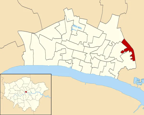
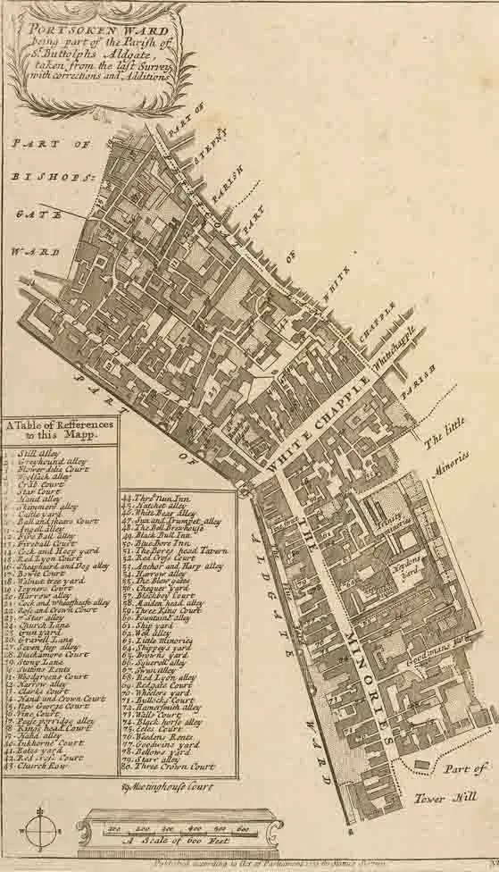
Portsoken, traditionally referred to with the definite article as the Portsoken,[3] is one of the City of London‘s 25 ancient wards, which are still used for local elections. (see maps – click to expand). Historically an extra-mural Ward, lying east of Aldgate and the City walls, the area is sometimes considered to be part of the East End of London.
The ward is about 5 hectares in area, and is mainly oriented north-south, with the central part informally known as Aldgate. John Stow‘s Survey of London records that the “soke” – in this context the right to extract fines as a source of income – (later “liberty“) was granted in the time of Saxon king Edgar the Peaceful, east of Aldgate to a guild of knights, the Cnichtengild, in exchange, essentially, for regular jousting. Norman kings confirmed these rights but later the land was voluntarily transferred to the Priory of the Holy Trinity by the descendants of the guild. In 1120 or 1121 (the exact date is unknown), the Portsoken was granted as a liberty to the Priory of Holy Trinity, which had been founded in 1107 by Queen Matilda, the wife of King Henry I. The sitting prior of Holy Trinity became, ex officio, an alderman of the City of London Corporation representing the Portsoken ward, and remained so until the Dissolution of the Monasteries by King Henry VIII in 1531. The Ward originally extended as far south as the Thames, but the growth of the Tower of London beyond the line of the London Wall, disputes with the Tower, the creation of the Liberties of the Tower of London and other factors resulted in the southern area being lost to the ward and to the City of London as a whole, after around 1200.
In 1332, a tax assessment showed 23 taxpayers in the Portsoken. However, this figure only included freemen of the City of London who possessed moveable property worth more than 10 shillings, and so did not include the poor, non-citizens, or members of religious orders. A later subsidy roll from 1582 showed that the ward’s taxpayers had been assessed to pay a total of 57 pounds, 11 shillings and 4 pence. The Portsoken has long had a mixed population, and in 1483 is recorded as having more aliens in its population than any ward in the City Of London. Since the 1840’s, nearly all of the Aldermen of the Ward have been Jewish.
Additional information
| Weight | 0.0121 kg |
|---|---|
| Dimensions | 25 × 35 cm |