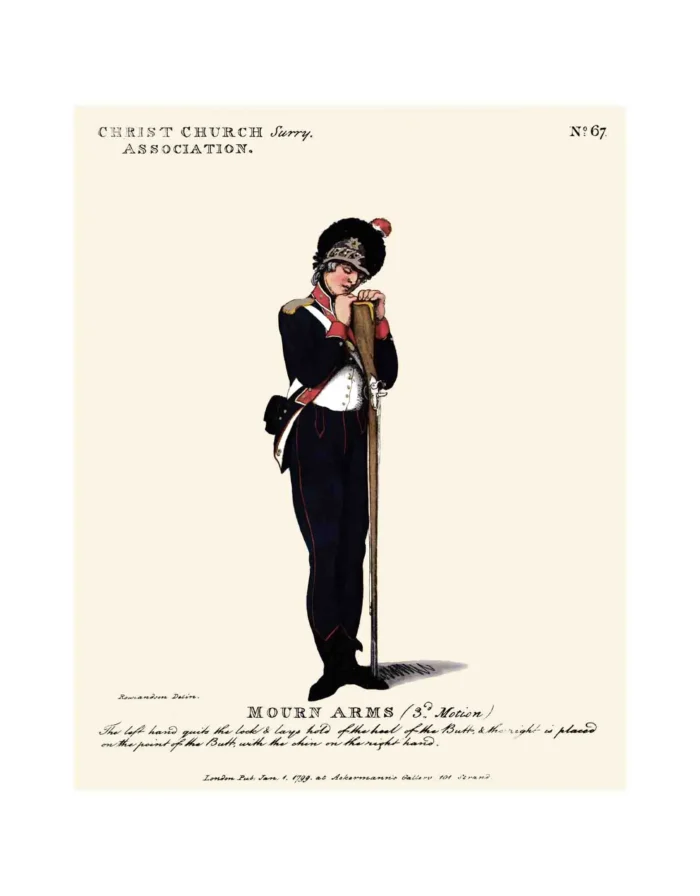
No. 67 Christ-Church, Surrey, Association
£15.00
Christchurch Surrey Parish (scroll down for a more detailed Description)
The first reprints of the 1798 aquatints by Thomas Rowlandson (published by Rudolph Ackermann) published in 1972 by Hugh Evelyn Limited.
Image size is 20.5 x 25.5 cm [8” x 10”] against a light greyish orange background (c. RGB fcf2e1) impressed on medium high white matt cartridge paper of c. 120 g/m2.
Print size: c. 26.2 x 33.7 cm [17” x 12 ¾”] may vary slightly from printers’ cut 50 years ago
Details of London Wards and Parishes provided by © the British Library
We offer thanks to the Trustees of the British Library and British Museum and Wikipedia for some text (and map outlines
Print is STANDARD size – shipping is the same for 1 to 10 prints (based on largest print size in your order) – see Shipping & Returns
Who were the Loyal Volunteers ? See here
In stock
Description

Christchurch (see map attached – click to enlarge) was a civil parish in the metropolitan area of London, England, located south of the River Thames straddling Blackfriars Road. It was the manor of Paris Garden of St Margaret, Southwark. St Margaret was replaced by St Saviour in 1541. In 1670 the area was made a parish in its own right when Christ Church was constructed. Prone to flooding, it was not heavily built on until after 1809. In 1900 the parish became part of the Metropolitan Borough of Southwark. The area now forms the north-western part of the London Borough of Southwark. Paris Garden was located adjacent to Southwark, in the Brixton Hundred in Surrey. It was considered to form part of “Southwark”. The area enjoyed special privilege as a liberty, which contributed to its poor reputation. You could avoid arrest within the liberty. William Baseley was granted a 21 year lease of the manor in 1542. In 1547 he was licensed to organise bowls, dice and other legally forbidden recreations. Paris Garden became infamous for bear and bull baiting during the 16th and 17th centuries. When the City of London extended its authority south of Thames in 1550 the liberties of the Clink and Paris Garden were not part of the new jurisdiction of the ward of Bridge Without.
When the Metropolitan Police was established in 1829 the parish was included in the initial Metropolitan Police District. Following the Reform Act 1832 it was added to the Parliamentary Borough of Southwark.[6] For the administration of the New Poor Law the parish was united with St Saviour as the St Saviour’s Union in 1836. The parish was small and, although the population had almost doubled in the first half of the 19th century, it was considered too small to form an administrative unit when local government in the metropolitan area of London was reformed in 1855.
Additional information
| Weight | 0.0121 kg |
|---|---|
| Dimensions | 25.5 × 32.5 cm |


