

No. 4 St. Mary Islington, Volunteer
£15.00
The Parish of St. Mary, Islington (scroll down for a more detailed Description)
The first reprints of the 1798 aquatints by Thomas Rowlandson (published by Rudolph Ackermann) published in 1972 by Hugh Evelyn Limited.
Image size is 20.5 x 25.5 cm [8” x 10”] against a light greyish orange background (c. RGB fcf2e1) impressed on medium high white matt cartridge paper of c. 120 g/m2.
Print size: c. 26.2 x 33.7 cm [17” x 12 ¾”] may vary slightly from printers’ cut 50 years ago
Details of London Wards and Parishes provided by © the British Library
We offer thanks to the Trustees of the British Library and British Museum and Wikipedia for some text (and map outlines
Print is STANDARD size – shipping is the same for 1 to 10 prints (based on largest print size in your order) – see Shipping & Returns
Who were the Loyal Volunteers ? See here
In stock
Description
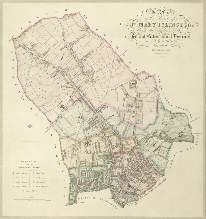
FIX BAYONETS [2nd motion] (see original 1798 description below)Islington (see map) is a district in Greater London, England, and part of the London Borough of Islington. It is a mainly residential district of Inner London, extending from Islington’s High Street to Highbury Fields, encompassing the area around the busy High Street, Upper Street, Essex Road (former “Lower Street”), and Southgate Road to the east. The Church of St Mary the Virgin is the historic parish church of Islington, in the Church of EnglandDiocese of London. The present parish is a compact area centred on Upper Street between Angel and Highbury Corner, bounded to the west by Liverpool Road, and to the east by Essex Road/Canonbury Road. The church is a Grade II listed building. Some roads on the edge of the area, including Essex Road, were known as streets by the medieval period, possibly indicating a Roman origin, but little physical evidence remains. What is known is that the Great North Road from Aldersgate came into use in the 14th century, connecting with a new turnpike (toll road) up Highgate Hill. This was along the line of modern Upper Street, with a toll gate at The Angel defining the extent of the village. The Back Road, the modern Liverpool Road, was primarily a drovers’ road where cattle would be rested before the final leg of their journey to Smithfield. Pens and sheds were erected along this road to accommodate the animals. The first recorded church, St Mary’s, was erected in the twelfth century and was replaced in the fifteenth century. Islington lay on the estates of the Bishop of London and the Dean and Chapter of St Pauls. There were substantial medieval moated manor houses in the area, principally at Canonbury and Highbury. In 1548, there were 440 communicants listed and the rural atmosphere, with access to the City and Westminster, made it a popular residence for the rich and eminent. The local inns harboured many fugitives and sheltered recusants. The churchyard was enlarged in 1793. With the rapid growth of Islington, it became full and closed for burials in 1853. It was laid out as a public garden of one and a half acres in 1885.
Additional information
| Weight | 0.0121 kg |
|---|---|
| Dimensions | 25 × 35 cm |


