

No. 60 Bread Street Ward Volunteer
£15.00
Bread Street Ward (scroll down for a more detailed Description)
The first reprints of the 1798 aquatints by Thomas Rowlandson (published by Rudolph Ackermann) published in 1972 by Hugh Evelyn Limited.
Image size is 20.5 x 25.5 cm [8” x 10”] against a light greyish orange background (c. RGB fcf2e1) impressed on medium high white matt cartridge paper of c. 120 g/m2.
Print size: c. 26.2 x 33.7 cm [17” x 12 ¾”] may vary slightly from printers’ cut 50 years ago
Details of London Wards and Parishes provided by © the British Library
We offer thanks to the Trustees of the British Library and British Museum and Wikipedia for some text (and map outlines
Print is STANDARD size – shipping is the same for 1 to 10 prints (based on largest print size in your order) – see Shipping & Returns
Who were the Loyal Volunteers ? See here
In stock
Description
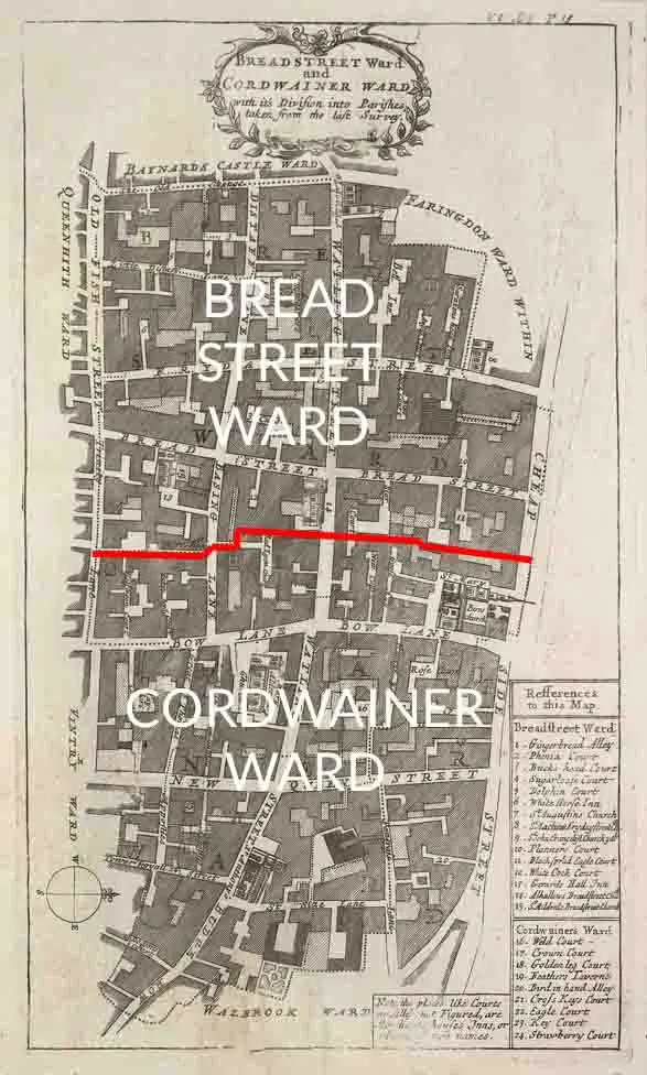
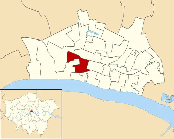
Bread Street (see maps – click to expand) is one of the 25 wards of the City of London the name deriving from its principal street, which was anciently the City’s bread market; already named Bredstrate (to at least 1180) for by the records it appears as that in 1302, Edward I announced that “the bakers of Bromley and Stratford-le-Bow [London], and ones already living on the street, were forbidden from selling bread from their own homes or bakeries, and could only do so from Bread Street. The street itself is just under 500 ft (153 m) in length and now forms the eastern boundary of the ward after the 2003 boundary changes. The modern ward extends much further west from Bread Street itself and includes Paternoster Square, a modern development to the north of St Paul’s Cathedral and home of the London Stock Exchange since 2004. The City’s major shopping centre which opened in 2010 is at One New Change within Bread Street Ward. As with most of the City’s 25 wards, the boundaries of Bread Street were altered quite considerably in 2003, having remained almost unchanged for centuries. The ward is now bounded on its north by Cheap Ward; to the east by Cordwainer Ward; to the south by Queenhithe and Vintry Wards; and to the west by Castle Baynard and Farringdon Within Wards. Its geographical boundaries are Bread Street in the east; Newgate Street and Cheapside in the north; Warwick Lane and Ave Maria Lane in the west; and Queen Victoria Street to the south. St Paul’s Cathedral is outside the ward boundaries, being in Castle Baynard Ward, but St Paul’s Cathedral School, situated between the cathedral and New Change is within the ward. Five successive Livery Halls of the Worshipful Company of Cordwainers (workers in fine leather) stood in the ward. They are commemorated by a blue plaque in the gardens of St Paul’s facing Cannon Street. The fifth and last hall was built between 1909–10, but on the night of 10 May 1941 was gutted during the Blitz. There were once two churches in the ward, All Hallows Bread Street and St Mildred, Bread Street, both to the design of Christopher Wren. Today their former parishes comprise part of St Mary-le-Bow on Cheapside. All Hallows was demolished in 1876 to make way for warehouses, and St Mildred was destroyed during The Blitz in April and May 1941.
Additional information
| Weight | 0.0121 kg |
|---|---|
| Dimensions | 25 × 35 cm |


