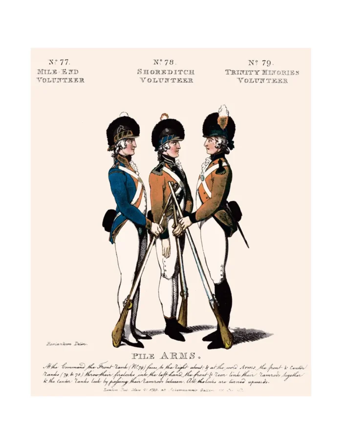
Nos 77, 78 & 79 Mile-End, Shoreditch and Trinity Minories Volunteers
£15.00
Mile End, Shoreditch and Trinity Minories (scroll down for a more detailed Description)
The first reprints of the 1798 aquatints by Thomas Rowlandson (published by Rudolph Ackermann) published in 1972 by Hugh Evelyn Limited.
Image size is 20.5 x 25.5 cm [8” x 10”] against a light greyish orange background (c. RGB fcf2e1) impressed on medium high white matt cartridge paper of c. 120 g/m2.
Print size: c. 26.2 x 33.7 cm [17” x 12 ¾”] may vary slightly from printers’ cut 50 years ago
Details of London Wards and Parishes provided by © the British Library
We offer thanks to the Trustees of the British Library and British Museum and Wikipedia for some text (and map outlines
Print is STANDARD size – shipping is the same for 1 to 10 prints (based on largest print size in your order) – see Shipping & Returns
Who were the Loyal Volunteers ? See here
In stock
Description
Mile End is a district of the London Borough of Tower Hamlets in the East End of London, England, 3.6 miles (5.8 km) east-northeast of Charing Cross. Situated on the London-to-Colchester road, it was one of the earliest suburbs of London. It became part of the metropolitan area in 1855, and is connected to the London Underground.
Shoreditch is a district in the East End of London in England, and forms the southern part of the London Borough of Hackney. Neighbouring parts of Tower Hamlets are also perceived as part of the area. In the 16th century, Shoreditch was an important centre of the Elizabethan Theatre, and it has been an important entertainment centre since that time. Today, it hosts many pubs, bars and nightclubs. The most commercial areas lie closest to the city of London and along the A10 Road, with the rest mostly residential.
Minories is the name of a small former administrative unit, and also of a street in central London. Both the street and the former administrative area take their name from the Abbey of the Minoresses of St. Clare without Aldgate. Both are positioned just to the east of, and outside, the line of London’s former defensive walls, in London’s East End. The area of the former administrative unit was outside the City of London (most recently in the London Borough of Tower Hamlets), with the street partially in the City and partly in Tower Hamlets. Boundary changes in 1994 mean the area of both is now wholly within the City of London.
Additional information
| Weight | 0.0121 kg |
|---|---|
| Dimensions | 25 × 35 cm |


